Diese Seite ist mehrsprachig verfügbar: English, Русский, عربي
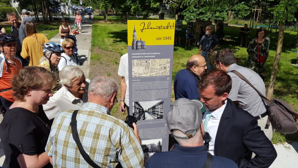
Mit dem Luftangriff vom 13. und 14. Februar 1945 fiel der größte Teil der Johannstadt in Schutt und Asche. Ein Stadtteil hörte nahezu auf zu existieren, nur Spuren sind geblieben. Doch die Johannstadt lebte weiter und entwickelte sich in den Folgejahren zum wichtigen zentrumsnahen Wohn- und Industriegebiet. Um die wechselhafte Geschichte des Stadtteils erlebbar zu machen, werden mit Förderung aus den Bund-Länder-Programmen Soziale Stadt / Sozialer Zusammenhalt an 12 Standorten im Fördergebiet Nördliche Johannstadt und dessen unmittelbarer Umgebung Infotafeln aufgestellt und durch einen historischen Rundweg mit Ausgangs- und Zielpunkt Trinitatisplatz miteinander verbunden.
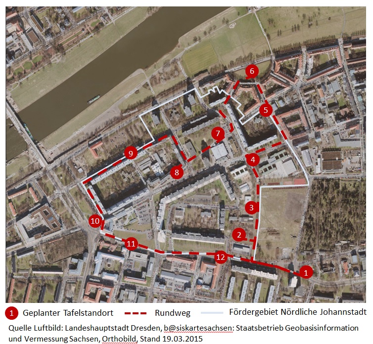
Zu den einzelnen Standorten:
- Trinitatisplatz
- Johanngarten
- Lili-Elbe-Straße
- Pfotenhauerstraße
- Arnoldstraße
- Thomas-Müntzer-Platz
- Stadtteilhaus, ehem. Blumenstraße
- Bönischplatz
- Florian-Geyer-Straße
- Güntz- / Sachsenplatz
- Gerok- / Marschnerstraße
- Gerok- / Silbermannstraße
Die Idee stammt aus der Bewohnerschaft. Im Zeitraum 2017-2020 trug eine offene Arbeitsgruppe aus Johannstadtarchiv, interessierten Bewohner*innen, dem Büro evergreen landschaftsarchitekten und dem Quartiersmanagement Nördliche Johannstadt hierzu Informationen und Bildmaterial zusammen. Parallel wurden die Informationen auch in Russisch, Arabisch und Englisch übersetzt und auf dieser Internetplattform sichtbar gemacht.
2017 wurde die erste Tafel im Johanngarten hinter der Johannstädter Rettungswache enthüllt. 2020 folgte die zweite Tafel auf dem Bönischplatz, 2023 die dritte an der Lili-Elbe-Straße. Die Aufstellung der Tafeln an den Standorten 1, 4-6 und 9-12 ist für 2024 geplant. Standort 7 am zukünftigen Stadtteilhaus folgt 2026.