
Diese Seite ist mehrsprachig verfügbar: English, Русский, عربي.
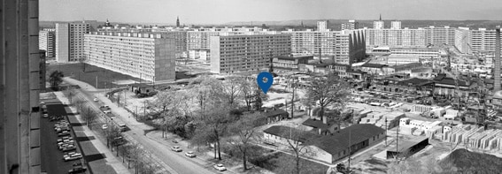
Vom Trinitatisplatz kommend, laufen Sie die Gerokstraße stadteinwärts und biegen vor der Johannstädter Rettungswache in die Lili-Elbe-Straße. Unmittelbar hinter der Rettungswache erreichen Sie den zweiten Standort des historischen Rundwegs, den Johanngarten.
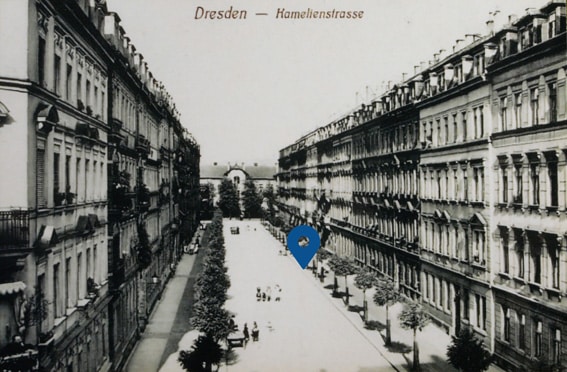
Vor 1945: Kamelienstraße und Carolahaus
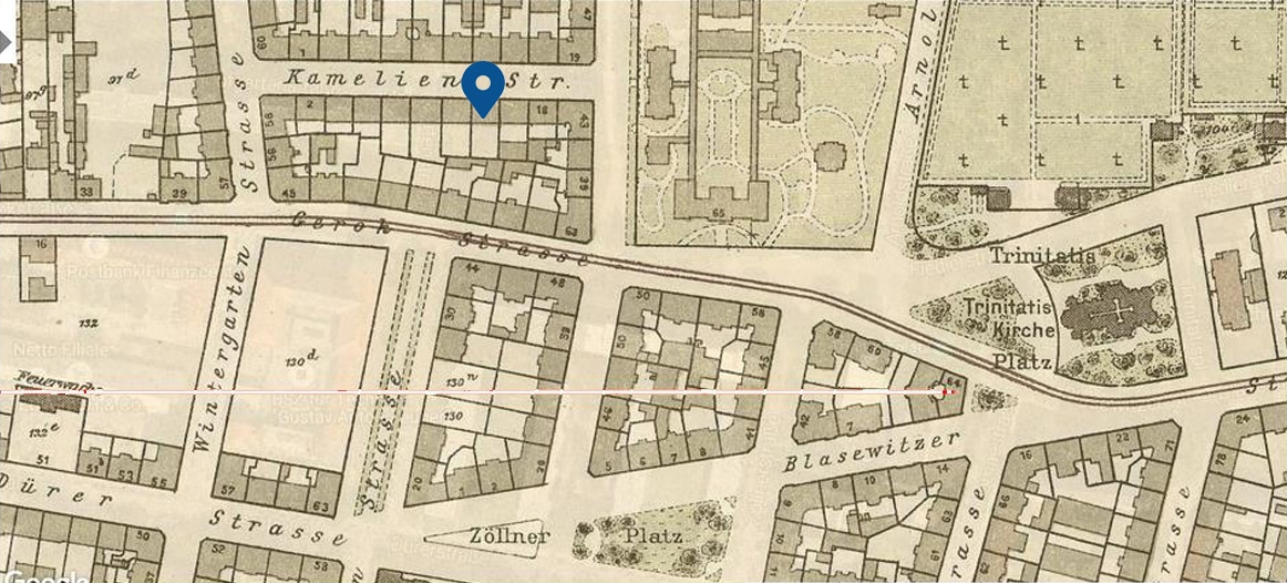
Kamelienstraße
Die 1876 angelegte Kamelienstraße, die einst am Standort der Tafel entlang führte, prägte das Gebiet als typische Wohnstraße aus der Gründerzeit. Die gleichmäßige Randbebauung diente fast ausschließlich zu Wohnzwecken. In den Hinterhöfen befand sich vereinzelt Kleingewerbe. Nachdem alle Wohnhäuser an der Kamelienstraße dem Bombardement 1945 zum Opfer fielen, verzichtete man auf die Wiedererrichtung der Fahrbahn. Heute ist sie zum Teil in die Hopfgartenstraße einbezogen.
Das Areal gehörte früher zum umfangreichen Grundstück „Hopfgarten“, später „Elisens Ruhe“. Zu Beginn des 19. Jahrhunderts wurde die große Anlage mehrfach geteilt. Einen Teil erwarb die Kunst- und Handelsgärtnerei Lüdicke, die unter anderem für ihre Kamelienzucht berühmt war. Gärtner Lüdicke legte 1859 einen Wintergarten an, der wegen seines Kamelienreichtums als botanische Sehenswürdigkeit galt. Nachdem der Garten 1878 schließen musste, entstanden auf dem Gärtnereigelände Wohngebäude. An die frühere Nutzung des Gebietes erinnern die Bezeichnungen Wintergartenstraße und Kamelienstraße.
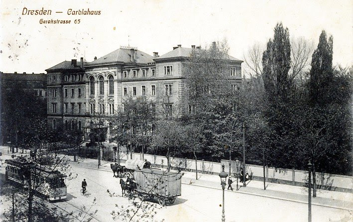
Die Kamelienstraße verband die Wintergarten- mit der Stephanienstraße am Carolahaus. Diese Tafel ist genau wie die Postkartenansicht mit Blick auf das Carolahaus ausgerichtet.
Weitere Informationen zur Geschichte der Kamelienstraße finden Sie hier.
Carolahaus
Das Carolahaus war das erste öffentliche Krankenhaus in der Dresdner Johannstadt. Der Albertverein eröffnete es 1878 und betrieb es als Krankenhaus bis in die 1930er Jahre. Die Einrichtung trug den Namen Carola von Wasa-Holstein-Gottorp, der letzten sächsischen Königin. Nach dem Ende des Ersten Weltkriegs verschlechterte sich die wirtschaftliche Situation des Carolahauses, was den Albertverein 1920 dazu zwang, das Krankenhaus an die Stadt Dresden zu verkaufen. 1934 zog eine Schule der Sturmabteilung (SA) in das Carolahaus. Mit dem Ausbruch des Zweiten Weltkriegs begann die Nutzung des Gebäudes als Lazarett. Im Februar 1945 fiel das Carolahaus den Luftangriffen auf Dresden vollständig zum Opfer.
Weitere Informationen zum Carolahaus finden Sie hier.
Nach 1945: Plattenwerk und Johanngarten: die etwas andere Grünfläche
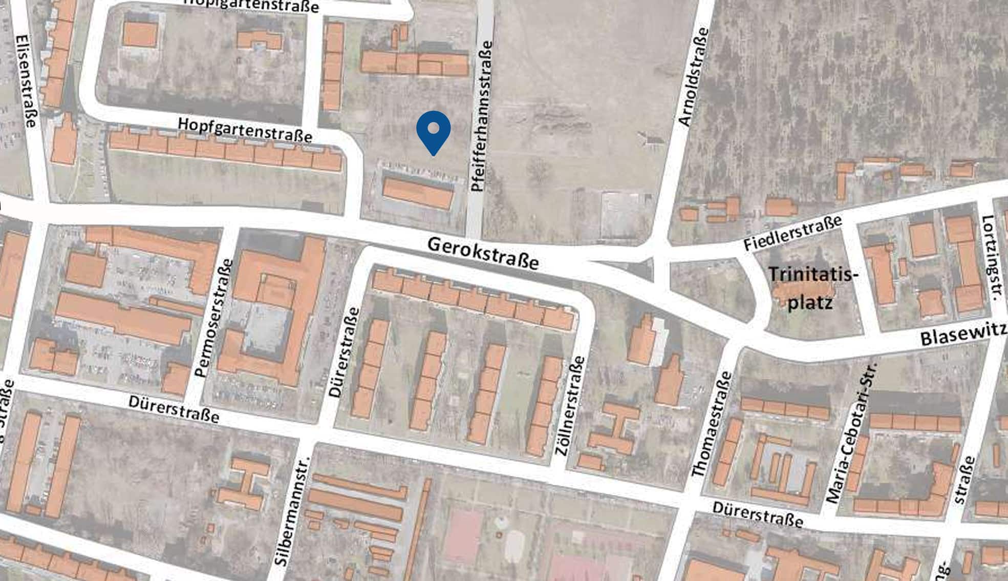
Plattenwerk Johannstadt
Nach dem Abriss der Reste des 1945 zerstörten Carolahauses entstand an seiner Stelle 1958 eines der ersten Plattenwerke der DDR, das auf dem sieben Hektar großen Gelände Betonfertigteile für den sozialistischen Wohnungsbau produzierte. Dazu recycelte es vor Ort tausende Tonnen Trümmer der 1945 zerstörten Gebäude der Dresdner Innenstadt und verwendete sie wieder als Bestandteil der Platten. Bis zu seiner Stilllegung 1990/91 stellte das Plattenwerk Material für mehrere zehntausend Dresdner, Riesaer und Coswiger Neubauwohnungen her, wobei es sich zuletzt auf Außenwandplatten spezialisierte.
Nach der politischen Wende verfiel das Gelände. Mit der Räumung verkaufte die Stadt Dresden die Fläche an einen privaten Investor. Ein kleiner Teil der Abbruchstoffe konnte für das Museumsprojekt Betonzeitschiene des Architekten Ruari O´Brien gesichert werden. Das Museum öffnete 2004, musste aber 2007 nach Ablauf der Nutzungsgenehmigung für die Fläche wieder schließen.
Weitere Informationen zur Geschichte des Plattenwerks finden Sie hier.
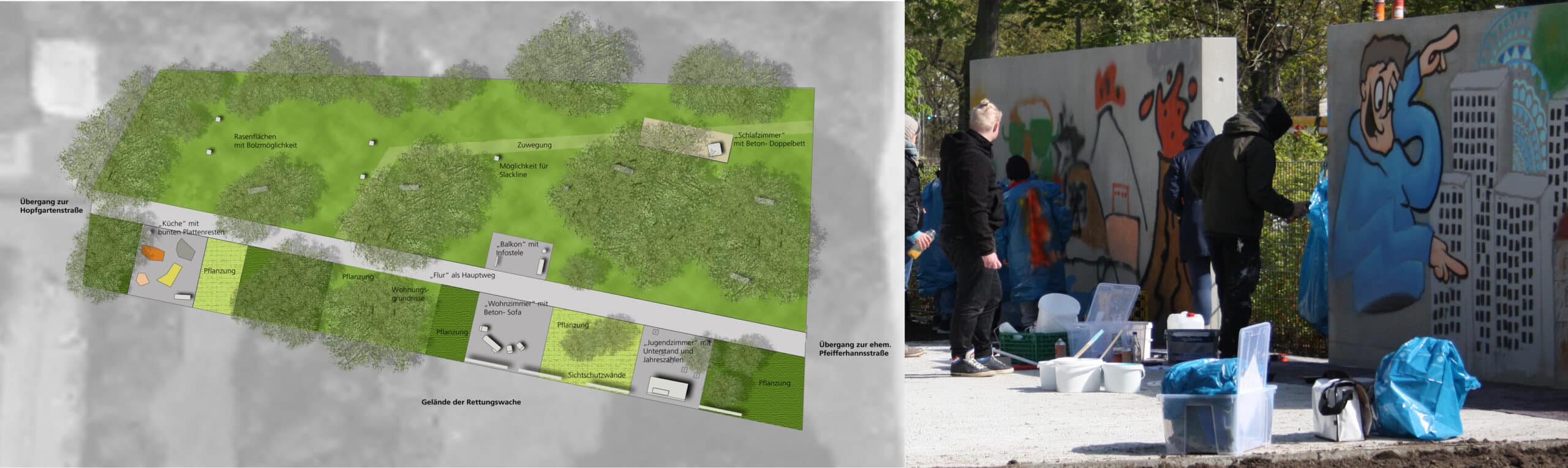
Johanngarten
Die Johannstadt hat seit 2017 einen neuen Quartierspark – den Johanngarten. Als Resultat einer intensiven Bürgerbeteiligung entstand auf dem Areal des ehemaligen Plattenwerkes und mit original Restbaustoffen aus der Produktion ein kleiner Park für alle Altersgruppen. Eine WBS-Dreiraumwohnung bildet mit allen Zimmern das thematische Leitmotiv. Im Wohnzimmer befindet sich eine komplette Betonsitzgruppe mit Couch und Sesseln, im Schlafzimmer ein Betondoppelbett. In der Küche blubbert ein buntes Ratatouille aus Plattenstücken im Topf, während der Balkon zum Ausruhen und (Tafel) Lesen anregt. Im Kinderzimmer befindet sich ein durch die Anwohnerschaft gewünschter Unterstand. Jahreszahlen im Boden verdeutlichen das Erwachsenwerden der Kinder.
Die angrenzenden Rasenflächen (ehemalige Kamelienstraße) laden zum Chillen, Bolzen und Sonnen nach Herzenslust ein. Der geradlinige Weg durch die Anlage besteht aus Betonplatten, die zum Teil von den Flächen vor dem Dresdner Kulturpalast stammen. Jugendliche aus dem Wohngebiet gestalteten die Sichtschutzwände während der Bauphase. Die Besucher und Besucherinnen des Bönischplatzfestes wählten 2016 den Namen Johanngarten aus einer Reihe von Vorschlägen.
Text: Matthias Erfurth, Matthias Kunert, Henning Seidler
Redaktionsschluss: April 2017